Exploration geologists drill hundreds of holes before finding a single economically viable deposit, and the global average success rate for greenfield mineral exploration sits somewhere between one in one hundred and one in two hundred.

This is a staggering failure rate costing the mining industry billions of dollars every year, delays critical supply chains for battery metals and rare earths, and leaves enormous environmental footprints across landscapes that never yield a return. The time, capital, and ecological cost of this trial-and-error approach have long been accepted as the price of doing business, but that assumption is now changing.
AI in mineral exploration fundamentally rewrites the odds — enabling exploration teams to process decades of geological, geochemical, geophysical, and remote-sensing data simultaneously, identify patterns that human analysts would take years to detect, and generate predictive targets with far greater precision than conventional methods. Teams can now rank prospective targets by probability scores derived from real data, so the drill bit lands in the right place far more often.
RTS Labs helps organizations build and deploy exactly these kinds of AI-powered systems, tailoring solutions to the specific data environments and operational realities of exploration programs.
This blog will walk you through what AI in mineral exploration actually means, where it is already delivering results, how to think about adopting it within your organization, and what the next decade of exploration will look like for teams that move early.
What AI in Mineral Exploration Actually Means
Exploration has always been a data problem. The challenge has never been a shortage of geological signals, but rather the inability to process everything the earth is telling us at once. AI changes that equation entirely, and to understand how, it helps to start with a clear picture of what the technology actually is.
Machine learning: finding patterns at scale
Machine learning algorithms identify statistical relationships across large datasets and use those relationships to classify, cluster, or predict outcomes.
In an exploration context, a machine learning model might ingest thousands of geochemical soil sample results alongside known deposit locations, learn which geochemical signatures reliably precede mineralization, and then score new survey areas against those signatures.
The model does not understand geology the way a geologist does, but it finds correlations in high-dimensional data at a speed and scale that human analysis cannot match.
The practical implication for an exploration team is significant here. Datasets that previously sat unanalyzed in legacy databases because there was never enough analyst time to work through them become productive inputs the moment a machine learning pipeline is pointed at them.
Historical geochemical surveys, airborne geophysics from campaigns conducted decades ago, and even digitized scanned paper drill logs can all serve as training material for models that generate new targeting insights from old data.
Deep learning: making sense of raw, complex signals
Deep learning is a subset of machine learning that uses layered neural networks to extract features from raw, unstructured data such as satellite imagery, seismic waveforms, or drill-core photographs.
Where a conventional machine learning model requires a human expert to engineer the input features, a deep learning model builds its own internal representations directly from the raw signal. This makes it particularly powerful when the relevant patterns are visually complex or spread across multiple data modalities.
In exploration, this translates to capabilities like:
- Automated classification of hydrothermal alteration zones from hyperspectral imagery
- Identification of fault traces in high-resolution topographic data
- Detection of mineralization intervals in drill-core photographs
All tasks that deep learning models have now demonstrated they can perform at a level comparable to, and in some cases exceeding, expert human analysts, at a fraction of the time and cost.
Also Read: AI Automation ROI: How to Calculate It (and Why Most Companies Get It Wrong)
Predictive modeling: turning data into ranked targets
Predictive modeling brings machine learning and deep learning together into an end-to-end workflow that generates ranked probability maps of prospectivity across a target region.
The model synthesizes lithological maps, structural geology, alteration patterns, geophysics, and historical drilling data into a single, interpretable output that tells an exploration team where to look next and, critically, why a given area has been ranked as a priority target.
The output of a predictive modeling workflow is not a black-box score that geologists are asked to accept on faith. Well-designed systems provide explainability layers that show which input features drove each target’s ranking, so the geological team can evaluate whether the model’s reasoning aligns with the district’s understood geological model and flag anomalous targets that may reflect data artifacts rather than genuine mineralization signals.
How AI processes geological data differently from humans
A senior exploration geologist brings irreplaceable contextual judgment to the table, but even the best geologist is limited by working memory, cognitive bandwidth, and the sheer volume of data that modern survey programs generate.
A single airborne electromagnetic survey over a moderately sized target area can produce terabytes of data in a matter of days, and integrating that with existing drill logs, geochemical assay databases, structural interpretations, and satellite-derived lithology maps is a task that no individual or small team can do comprehensively by hand.
The difference in how AI handles this workload comes down to a few specific capabilities that operate in combination:
• Simultaneous multi-dataset integration:
An AI model ingests geochemical, geophysical, structural, and remote-sensing layers simultaneously, evaluating each data point relative to every other across all layers, rather than working through each dataset sequentially, as human analysts must.
• Fatigue-free consistency:
The model applies the same classification and scoring criteria to the ten-millionth data point as it does to the first, eliminating the drift in interpretation standards that creeps into any large manual analysis project over time.
• Detection of sub-threshold signals:
AI models identify subtle multi-element halos and structural alignments that sit below the threshold of human visual perception but are statistically meaningful predictors of deposit presence, effectively extracting geological signal from what looks to a human like background noise.
• Dynamic model updating
As new data arrives from ongoing surveys or drilling, AI models can be retrained or updated in near-real time, so the geological interpretation stays current throughout the program rather than being frozen at the point of the last manual interpretation cycle.
• Explainable output:
Modern AI systems produce ranked target lists accompanied by feature importance scores, so geologists can see exactly which combination of inputs drove each target’s ranking and evaluate whether the model’s logic is geologically coherent.
Key Applications of AI in Mineral Exploration
Ask any exploration manager where their program loses the most time and money, and the answer almost always comes back to one of four places:
- Targeting decisions made on incomplete data,
- Remote sensing that takes months to interpret,
- Drilling programs that adapt too slowly to new information, and
- Field data that sits unintegrated until the season is over.
These are exactly the four areas where AI is delivering the most measurable value today.
1. Predictive targeting and deposit modeling
Predictive targeting is the flagship application of AI mineral exploration, and it is where the business case for adoption is clearest and most quantifiable. The core idea is to train a model on a labeled dataset of known mineral occurrences and their surrounding geological features, then apply it to unexplored or under-explored ground to produce a ranked list of priority targets.

How predictive targeting works
- Build the training dataset: compile historical drill results, geochemical surveys, geophysical grids, and geological maps for an area where the deposit distribution is known, and label each data point with its known geological outcome.
- Train the model: run a machine learning algorithm across the training dataset to identify the combination of input features that most reliably predicts the presence of economic mineralization in the labeled examples.
- Apply to new ground: run the trained model across unexplored or under-explored areas where the same data types are available, generating a prospectivity score for every cell in the target region.
- Rank and validate targets: sort the output by prospectivity score, review the top-ranked targets against the geological model, and select drill targets from the validated priority list.
SRK Consulting and several major junior explorers have published work demonstrating that AI-generated targeting reduces the number of drill holes required to find a significant intersection by 30%-60%, depending on the deposit type and the quality of the training data.
In practical terms, that means a company with a budget of ten million dollars for a drilling program can either drill twice as many targets at the same cost or achieve the same number of meaningful intersections at half the cost, a transformation in capital efficiency that changes the economics of exploration fundamentally.
Also Read: AI-Driven Safety in Oil and Gas: Improving Risk Visibility Across Complex Operations
2. Deposit modeling in three dimensions
Deposit modeling extends the predictive targeting approach into three dimensions, using AI to build probabilistic block models from drill intercept data, geophysical inversions, and structural interpretations. These models update dynamically as new drilling data comes in, so the exploration team always has a current, data-informed view of where the deposit boundary sits and where the highest-grade material is likely to be concentrated.
Traditional vs. AI-assisted exploration targeting: a comparison
| Factor | Traditional approach | AI-assisted approach |
|---|---|---|
| Target generation time | Months to years of manual interpretation | Days to weeks with model-assisted ranking |
| Data integration | Sequential, limited to analyst bandwidth | Simultaneous, across all available data streams |
| Drill success rate | 1 in 100 to 200 on greenfield ground | Up to 2–3x improvement with quality training data |
| Cost per meaningful intersection | Extremely high on average | Significantly reduced through better targeting |
| Model updating | Periodic, requires new interpretation cycle | Dynamic, updates as new data arrives |
2. Remote sensing and satellite data analysis
Remote sensing has been part of the exploration toolkit for decades, but the volume and resolution of satellite data available today vastly exceed what any traditional interpretation workflow can handle.
Multispectral and hyperspectral sensors aboard platforms like Sentinel-2, ASTER, and WorldView-3 capture surface reflectance data across dozens of spectral bands, allowing trained models to map hydrothermal alteration assemblages, iron oxide distributions, clay mineralogy, and vegetation stress patterns that serve as geochemical proxies for subsurface mineralization.
What AI extracts from satellite data
- Alteration mapping
Deep learning models trained on labeled spectral datasets classify hydrothermal alteration signatures across entire regions in hours, producing alteration maps that would previously have required weeks of manual spectral analysis and field validation.
A copper-gold porphyry program in the Andes, to take one well-documented example, used AI-driven hyperspectral analysis to reduce its initial target area from 800 square kilometers to 12 priority zones in 3 weeks, saving an estimated 6 months of traditional mapping time before a single drill hole was collared.
- Structural feature extraction
The same approach applies to structural mapping from high-resolution digital elevation models. AI models trained to recognize fault traces, fold axes, and hydrothermal breccia pipe morphologies extract structural features from terrain data at a level of detail and consistency that exceeds what human mapping teams can produce in the field, and do so across areas far too large for practical ground-based structural surveys.
- Vegetation and geochemical proxies
Vegetation stress anomalies detectable in near-infrared and red-edge spectral bands have long been used as indirect indicators of soil geochemistry anomalies related to mineralization.
AI models trained on coincident vegetation stress and geochemical datasets can quantify the relationship between spectral vegetation response and specific element anomalies, extending the reach of geochemical prospecting to areas where direct soil sampling is impractical due to terrain, vegetation density, or permafrost cover.
3. Drilling optimization and resource estimation
Once a drill program is underway, AI continues to add value by optimizing drill hole placement in real time and improving the accuracy of resource estimates. Adaptive drilling algorithms analyze intercept results as they arrive and continuously update the three-dimensional deposit model, recommending the next hole location based on the current state of geological knowledge rather than on the plan designed before drilling began.
Adaptive drill planning
Resource estimation has traditionally relied on geostatistical methods like ordinary kriging, which make strong assumptions about the spatial continuity of grade that are not always satisfied in structurally complex deposits.
Machine learning approaches, including neural network-based grade estimation and gradient-boosted models trained on dense drill data, have demonstrated superior performance in capturing grade discontinuities and anisotropies that kriging smooths over, resulting in resource estimates that better reflect the actual deposit geometry.
Also Read: What Is Process Mining AI? Use Cases, Benefits, and Strategy
Automated core logging
Automated logging of drill core using computer vision is another area where AI is saving significant time and improving data consistency. Systems trained on large libraries of labeled core photographs classify rock type, estimate alteration intensity, identify mineralization intervals, and measure structural features like fracture frequency and orientation. They produce a digital log at a fraction of the cost and time of manual logging while maintaining a consistent classification standard across the entire program.
What automated core logging captures
- Rock type classification against the program’s lithological scheme
- Alteration intensity scoring on a standardized scale
- Mineralization interval identification with grade proxies from color and texture
- Structural feature measurement, including fracture frequency, orientation, and fill type
- Geotechnical parameters relevant to resource modeling and mine planning
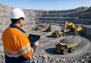
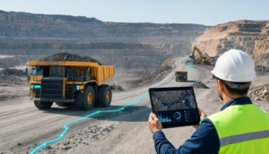
4. Real-time data integration from field sensors
The integration of real-time field sensor data into AI-driven decision workflows represents one of the most significant emerging developments in exploration technology. Ground-based geophysical instruments, downhole sensors, portable XRF analyzers, and drone-mounted payloads now generate continuous data streams that can feed directly into cloud-hosted models, allowing exploration teams to make targeting decisions based on information that is hours old rather than months old.
How the sensor-to-model pipeline works
- Data acquisition: field sensors collect geophysical, geochemical, and structural data continuously and transmit readings via satellite or cellular connectivity to a cloud data ingestion layer.
- Automated QA and integration: incoming data passes through automated quality-control checks and is integrated with the existing project database, flagging anomalous readings that exceed defined thresholds for geologist review.
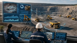
- Model inference: the updated dataset feeds into the targeting model, which reruns prospectivity scoring across the project area and updates the ranked target list accordingly.
- Alert and decision support: the system pushes flagged anomalies and updated target rankings to the exploration team’s dashboard, enabling real-time decisions on drill program adjustments without waiting for end-of-season data compilation.
Internet of Things (IoT)-enabled sensor networks deployed across a project area monitor soil gas anomalies, induced polarization responses, and ground deformation patterns simultaneously, feeding all of this data into a central integration platform where AI algorithms identify spatial correlations and flag emerging anomalies for geologist review.
This kind of continuous, data-driven monitoring dramatically compresses the feedback loop between data acquisition and geological interpretation, allowing programs to adapt their strategies mid-campaign rather than waiting until post-season data compilation is complete.
Real-World Examples and Case Studies
It is easy to be skeptical of new technology until you see it working in the field, under real exploration conditions, with real drill results to validate the predictions. The evidence base for AI mineral exploration has now grown well beyond proof-of-concept pilots, and the companies generating that evidence range from globally diversified majors to single-project junior explorers.
Companies already using AI mineral exploration tools
A growing number of junior explorers and mid-tier producers are deploying AI-driven targeting workflows, either through partnerships with specialized technology providers or by building internal capabilities.
- Rio Tinto has been among the most public about its investment in AI-driven exploration, using machine learning models to prioritize targets from its global geochemical database and integrating AI into its Mine of the Future initiative.
- Goldspot Discoveries, a company operating at the intersection of AI and mineral exploration, has published case studies demonstrating how its machine learning platform has identified high-priority gold targets in the Abitibi greenstone belt of Ontario. These targets were subsequently confirmed by drilling, with several intersections exceeding the grades and widths suggested by the surrounding historical data.
- BHP and Anglo American have similarly built AI-driven prospectivity analysis into their global exploration workflows, using training datasets that span decades of historical drilling and geochemical surveys.
At the junior end of the market, companies like Kore Mining and Hercules Silver have partnered with AI exploration technology providers to generate priority targets on properties where conventional programs had stalled, demonstrating that AI-assisted targeting is accessible and economically justified even for small-budget programs.
Results: faster discovery, lower costs, reduced environmental footprint
Results across these programs are consistent:
- Fewer holes drilled to achieve the same level of geological confidence,
- Faster progression from initial targeting to resource definition, and
- A measurably reduced environmental footprint of exploration activities.
Improved hit rate
When a program drills thirty percent fewer holes because AI targeting has improved the hit rate, it also disturbs thirty percent less land surface, generates thirty percent less drill cutting waste, and consumes thirty percent less fuel and water. These benefits matter increasingly to regulators and the host communities alike.
Time-to-discovery
Time-to-discovery has also compressed significantly in programs that have adopted AI-driven workflows. A deposit type that historically required seven to ten years of exploration work from first sampling to maiden resource estimate has been achieved in three to four years in several recent AI-assisted programs, primarily because the iterative cycle of data acquisition, interpretation, and target prioritization runs so much faster when AI handles the data processing burden.
Financial Benefits
The financial implications are equally striking. Junior exploration companies that have published comparative cost data report reductions in per-hole targeting costs of between 20%-40% when AI-generated target lists replace conventional geological ranking, which directly improves the capital efficiency of exploration spend and extends the runway available to programs operating on limited budgets.
Reported outcomes from AI-assisted exploration programs
| Metric | Conventional program | AI-assisted program |
|---|---|---|
| Drill success rate | 0.5 to 1% | 1.5 to 3% (reported range) |
| Time from sampling to maiden resource | 7 to 10 years (average) | 3 to 5 years (AI-assisted) |
| Per-hole targeting cost reduction | Baseline | 20 to 40% lower |
| Land disturbance per discovery | High, due to volume of holes | Materially reduced |
| Data integration turnaround | Weeks to months | Hours to days |
How to Get Started with AI in Your Exploration Program
Deciding to adopt AI in exploration is easy; knowing where to start is harder. The organizations that have struggled with AI adoption almost always trace the difficulty back to one of three things: data that is not ready for modeling, teams that have not yet built the skills to interpret AI outputs, or workflows that were not designed to capture the data AI systems depend on. Addressing these gaps systematically, before selecting any technology platform, is the foundation of a successful adoption.
What to assess internally before adopting AI
Before evaluating any AI platform or engaging a technology partner, the most important step is an honest internal audit of where your organization actually stands with respect to data, people, and process.
- The first question to ask is whether your historical drill hole database is clean, consistently coded, and stored in a format that can be queried programmatically.
Collar coordinates in multiple datum systems, assay intervals with inconsistent sample length conventions, and lithological logs coded differently by different geologists across different years. These are the kinds of data quality problems that surface immediately when you try to build a training dataset, and resolving them often takes longer than building the model itself.
- The second question is whether your team has the geological knowledge to design a meaningful training dataset and interpret model outputs critically.
AI tools are decision-support systems, not autonomous geologists, and their outputs need to be reviewed and validated by people who understand the geological context. A program that deploys AI without sufficient geological expertise in-house risks misinterpreting model outputs and drilling targets that are statistically generated but geologically implausible.
- The third question is about process readiness: does your exploration workflow include the data-acquisition steps that AI models depend on, such as consistent geochemical sampling, systematic geophysical coverage, and structured field observation protocols?
If your data collection is opportunistic and inconsistently documented, then adopting AI is a downstream fix for an upstream problem, and the upstream problem needs to be addressed first.
What capabilities and data infrastructure do you need
Once you have assessed your current state, the next step is to map out what infrastructure gaps need to be closed before AI adoption becomes practical. The three core requirements are a centralized data repository, a geospatial processing environment, and a model deployment and monitoring framework.
Centralized data repository
A centralized data repository is a single source of truth for all geological, geochemical, and geophysical data, structured to enable programmatic access and version control. This does not necessarily mean building a bespoke enterprise data platform; cloud-hosted geological data management systems like acQuire, or Leapfrog Geo, combined with a cloud storage layer can serve this purpose effectively for most exploration companies.
Geospatial processing environment
A geospatial processing environment is needed to handle the raster and vector data that form the backbone of most AI-targeting workflows, including rasterized geophysical grids, classified remote sensing layers, digitized geological maps, and structural interpretations. Python-based environments with libraries such as Geospatial Data Abstraction Library (GDAL), Rasterio, and GeoPandas, deployed on cloud computing infrastructure, can handle these workloads cost-effectively for most exploration programs.
Model deployment and monitoring framework
A model deployment and monitoring framework ensures that models are not just trained once and left to run indefinitely, but are updated as new data arrives, monitored for drift as geological conditions change, and validated against new drilling results on a structured cycle. This is the piece of the infrastructure stack that most exploration companies overlook when they first adopt AI, and it is the piece that determines whether AI delivers sustained value or becomes a one-off experiment.
How partnering with RTS Labs can bridge the gap
RTS Labs works with exploration organizations at every stage of this readiness journey. The starting point for any engagement is a discovery workshop where the RTS Labs team maps your current data environment, identifies the highest-value AI applications for your specific program type and geological setting, and defines a technically achievable roadmap that respects your budget and timeline constraints.
Where in-house data science capability is limited or absent, RTS Labs provides the full technical stack, building and training models on your proprietary dataset, integrating outputs into the geological software tools your team already uses, and transferring the knowledge and documentation needed for your team to operate and maintain the system independently. The goal is to build genuine internal capability alongside a technical partner who understands both the AI and the geology.
Programs that are earlier in their data maturity journey can start with a targeted data remediation and standardization engagement before moving to model development, ensuring that the foundational infrastructure is in place to support AI at scale rather than rushing to deployment on a weak data foundation.
The Future of AI Mineral Exploration and How to Get There
The trajectory of AI in mineral exploration is far from speculative. The underlying trends in satellite data availability, computational costs, and model architectures are accelerating. Teams that understand where this technology is heading have a meaningful opportunity to build capability now that will compound into a significant competitive advantage over the next decade.
The next five to ten years of AI in mineral exploration will be defined by three converging trends: the commoditization of satellite and geophysical data, the maturation of foundation models trained on global geological datasets, and the integration of autonomous field systems that close the loop between data acquisition and AI-driven decision-making.
Teams that want to be operating at the frontier of this technology in 2030 need to be building the data infrastructure, internal capability, and technology partnerships today. The learning curve for AI adoption in exploration is real, and the companies that start now will have a compounding advantage over those that wait for the technology to be fully mature before engaging with it.
RTS Labs is positioned to help exploration organizations build exactly the kind of AI capability that will define competitive advantage over the next decade, from foundational data engineering through to cutting-edge model development, deployment, and the ongoing program support that ensures AI continues to deliver value as your portfolio evolves. The expertise, the technical infrastructure, and the geological and data science knowledge needed to move your program forward are available now.
Frequently Asked Questions
Q1. How much historical data does an exploration company need before AI targeting becomes viable?
There is no universal threshold, but practitioners generally find that a training dataset of at least one hundred to two hundred drill holes with consistent geological logging and assay data, combined with regional geophysical and geochemical coverage, is sufficient to train a useful first-generation targeting model. Programs with sparser data can still benefit from transfer learning approaches that use global geological training datasets.
Q2. Can AI in mineral exploration work for all deposit types, or is it better suited to certain commodities?
AI targeting has been applied successfully across gold, copper, nickel, lithium, rare earth elements, and polymetallic deposit types, among others. The performance of any model depends heavily on the consistency and completeness of the training data rather than the specific commodity, although structurally simple disseminated deposits tend to produce cleaner training signals than structurally complex vein or skarn systems.
Q3. What is the typical timeline from initial engagement to having a working AI targeting model deployed on a project?
Timelines vary depending on data readiness and project complexity, but most programs can achieve a functional first-generation targeting model within three to six months of beginning a structured data remediation and model development engagement. Programs where data is already clean and centralized can move faster, while those requiring significant legacy data work will need additional time upfront.
Q4. How does RTS Labs handle proprietary geological data, and what data security measures are in place?
RTS Labs operates under strict data governance frameworks, including non-disclosure agreements, encrypted data transfer protocols, and deployment options that keep client data within the client’s own cloud environment so that proprietary geological databases never leave your infrastructure. The technical architecture for any engagement is designed around the client’s specific security requirements, and the RTS Labs team works within those constraints from the outset of the project.
Q5. Will AI in mineral exploration replace geologists, or does it work alongside them?
AI tools in exploration are decision-support systems, and their outputs always require geological interpretation and validation by qualified professionals. The value of AI lies in processing and synthesizing data at a scale and speed that human analysis cannot match, not in replacing the contextual geological judgment that distinguishes a plausible target from a statistically generated artifact. Programs that integrate AI most effectively treat it as a force multiplier for their geological team rather than a substitute for geological expertise.